
In order to use resources efficiently and maximise productivity during the seed harvest, it is crucial to have made a prior assessment of the yield and quality of the seed in the tree stands. However, traditional methods of crop evaluation are often time-consuming and resource-intensive. Drones offer a cost-effective means of capturing high-resolution image data and have proven to be valuable tools in agriculture and forestry. In the UAV-SEE project, the Bavarian State Institute of Forestry (LWF) and the Office for Forest Genetics (AWG) are working together to investigate possible uses of drones to take aerial photographs and collect samples directly from the tree crowns.
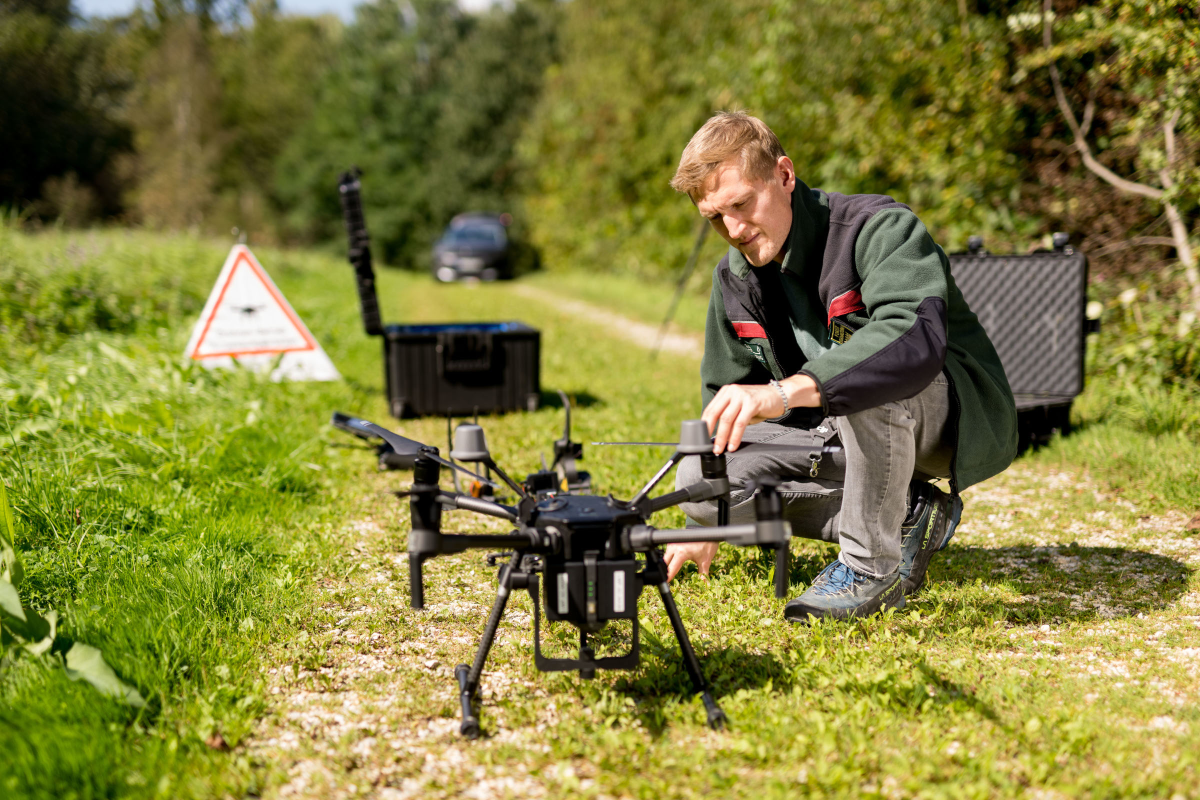
Fig. 1: Quadcopter with mounted gripper arm including camera is prepared for take-off. Photo: Tobias Hase
Drone images as a basis for crop yield forecasts
Drone images and so-called orthophotos are used for crop yield forecasts and to survey stands. Orthophotos provide a rectified, geo-referenced and true-to-scale representation of the Earth’s surface, making precise and consistent analyses possible. The data collection process includes the planning of the drone flight and the post-processing of the images using special photogrammetry software to create a seamless and accurate orthophoto. This method makes it possible to quantify and estimate the seed crop yield, as well as allocate it to individual trees, providing valuable information for management purposes.
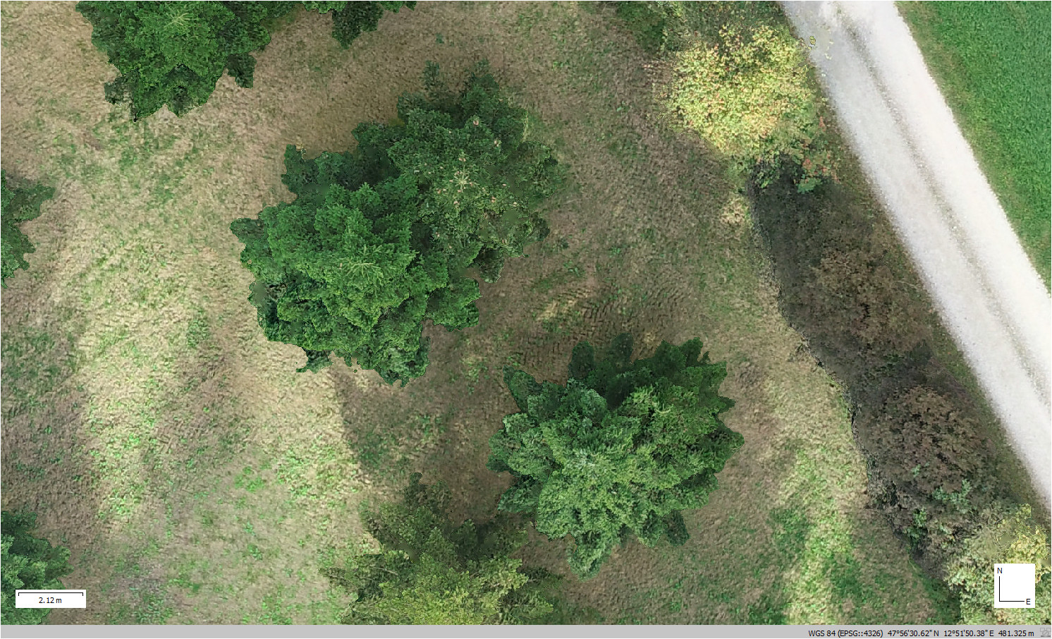
Fig. 2: Section of an orthophoto showing two silver firs - one with clearly visible cones and one from which the cones have already been harvested.
By using machine learning methods, orthophotos can be analysed automatically to distinguish productive from less productive trees. This provides valuable information for the management and optimisation of harvesting processes.
When using drone-borne cameras for crop forecasting, the resolution should be set very high, especially for trees with small seeds such as beech. To avoid the drone having to fly at too low an altitude, particularly high-resolution cameras are thus required. Optimal weather conditions are advantageous: there should be little to no wind; continuous cloud cover provides diffuse light and thus uniform illumination of the tree crown, also reducing the casting of shadows.
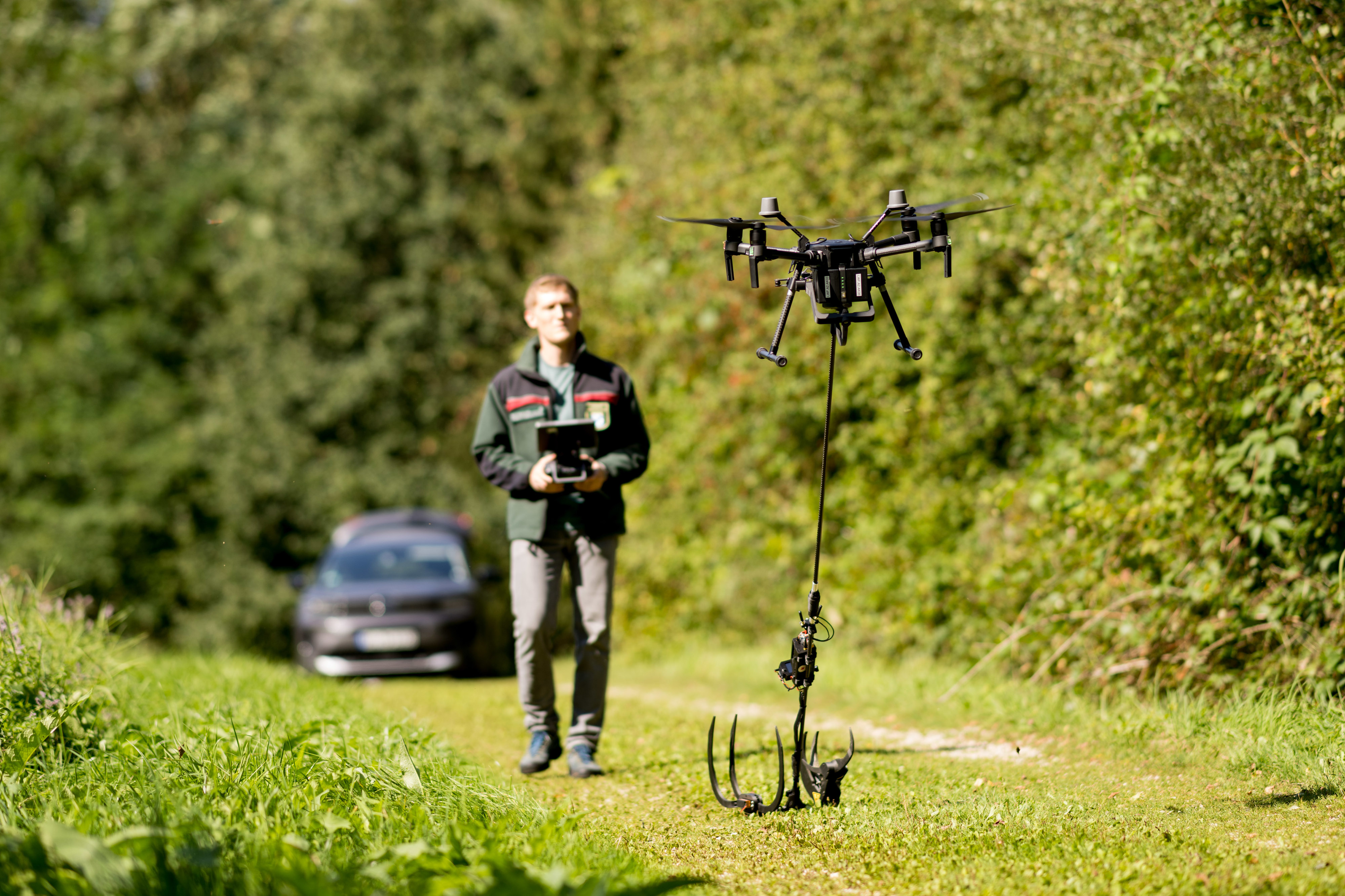
Fig. 3: DJI Matrice 210 RTK drone takes off for a test flight. Photo: Tobias Hase
For optimal orthophotos, flying in a double-grid pattern is recommended. In difficult conditions, the drone should even stop briefly for each image, to maximise image quality. This procedure does however result in long flight times, which reduces the size of the areas covered per flight. In addition, crop forecasting with the camera requires a lot of high-quality training data on different tree species and their seeds in order to use deep learning models effectively to count the seeds. Extensive manual labelling work is required to create these training data.
For direct sampling, we use a drone-borne gripper arm. This technology allows the collection of branch samples for DNA analyses and seed samples for quality assurance, which would otherwise be difficult to obtain. The gripper arm is mounted on a carrier drone. It consists of a gripper and a small circular saw, which is operated with its own rechargeable battery. The gripper is controlled by a separate remote control unit equipped with a display that visualises the gripping process in real time. This enables the pilot to approach the tree and to grip and cut the selected branches with precision.
A DJI Matrice 210 RTK drone including a ground station is used to operate the gripper arm. In addition, 14 drone batteries are required. The drone requires two batteries for operation, so with 14 batteries, seven flights of about 15-20 minutes each can be taken. A camera is mounted above the gripper arm to record the gripping process.
Taking branch samples by drone eliminates the need for climbing
The sampling process begins by determining the orientation of the gripper arm (vertical, horizontal or somewhere between), depending on the direction of growth of the branches. The drone is then launched and manoeuvred to a safe altitude. It then heads for the sample tree and uses the camera to select a suitable branch. As soon as the branch is within the range of the gripper arm, the gripping sequence is triggered. The gripper arm grabs the branch and presses it against the rotating saw blade until the branch is cut through. The gripper arm continues to grip and the branch can be safely transported.
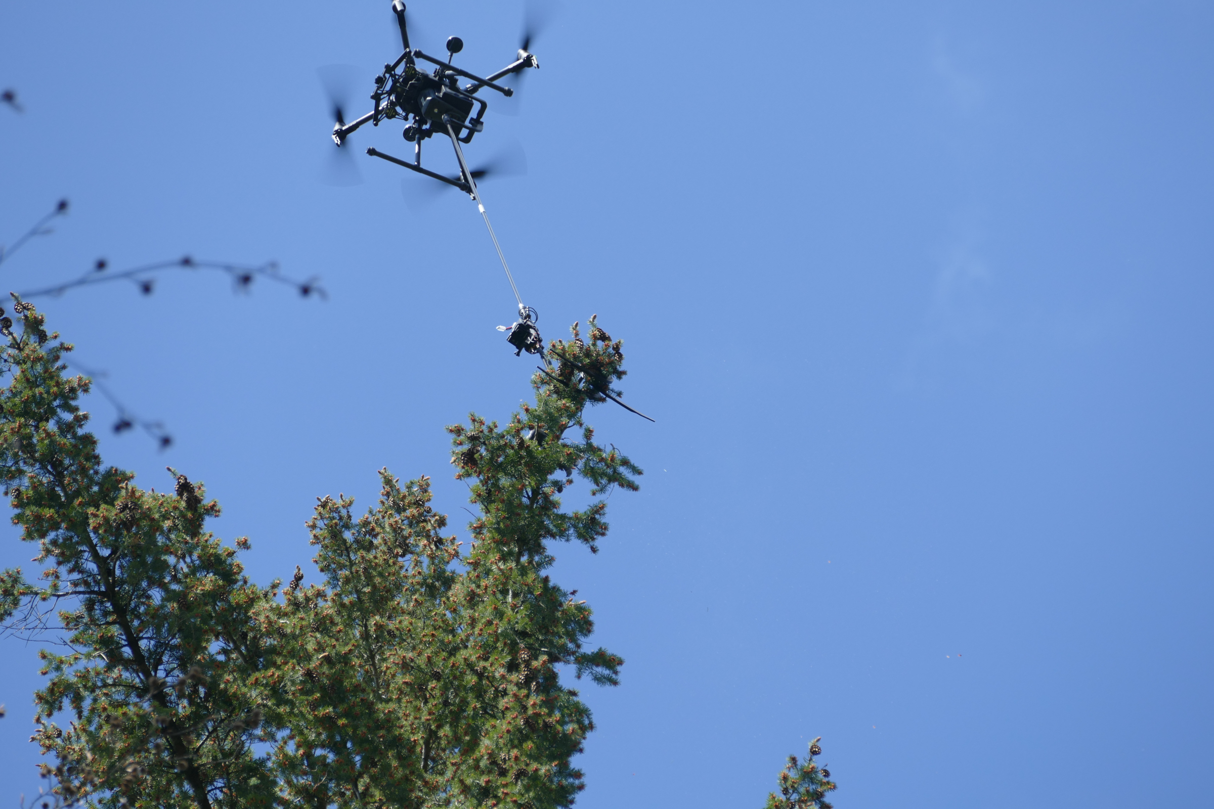
Fig. 4: Drone approaches a chosen sample branch and the gripping and cutting sequence is triggered. Photo: Andreas Müller (AWG)
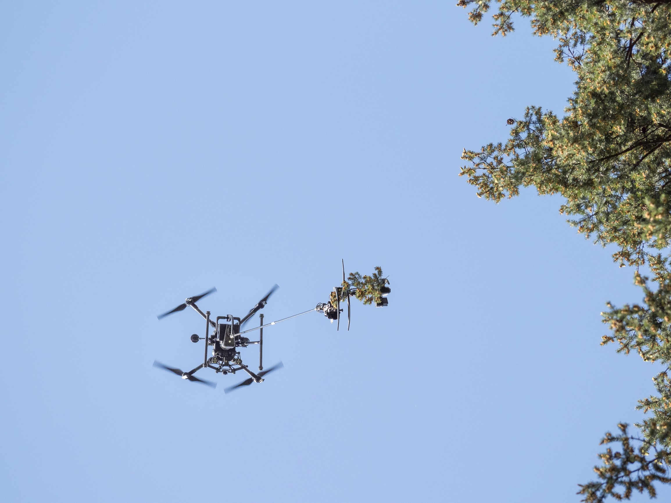
Fig. 5: Branch sample is transported safely to the pilot. Photo: Andreas Müller (AWG)

Fig. 6: Perspective of the gripper arm camera. A horizontally aligned gripper arm is guided to the sample branch. Photo: Simon Ecke (LWF)
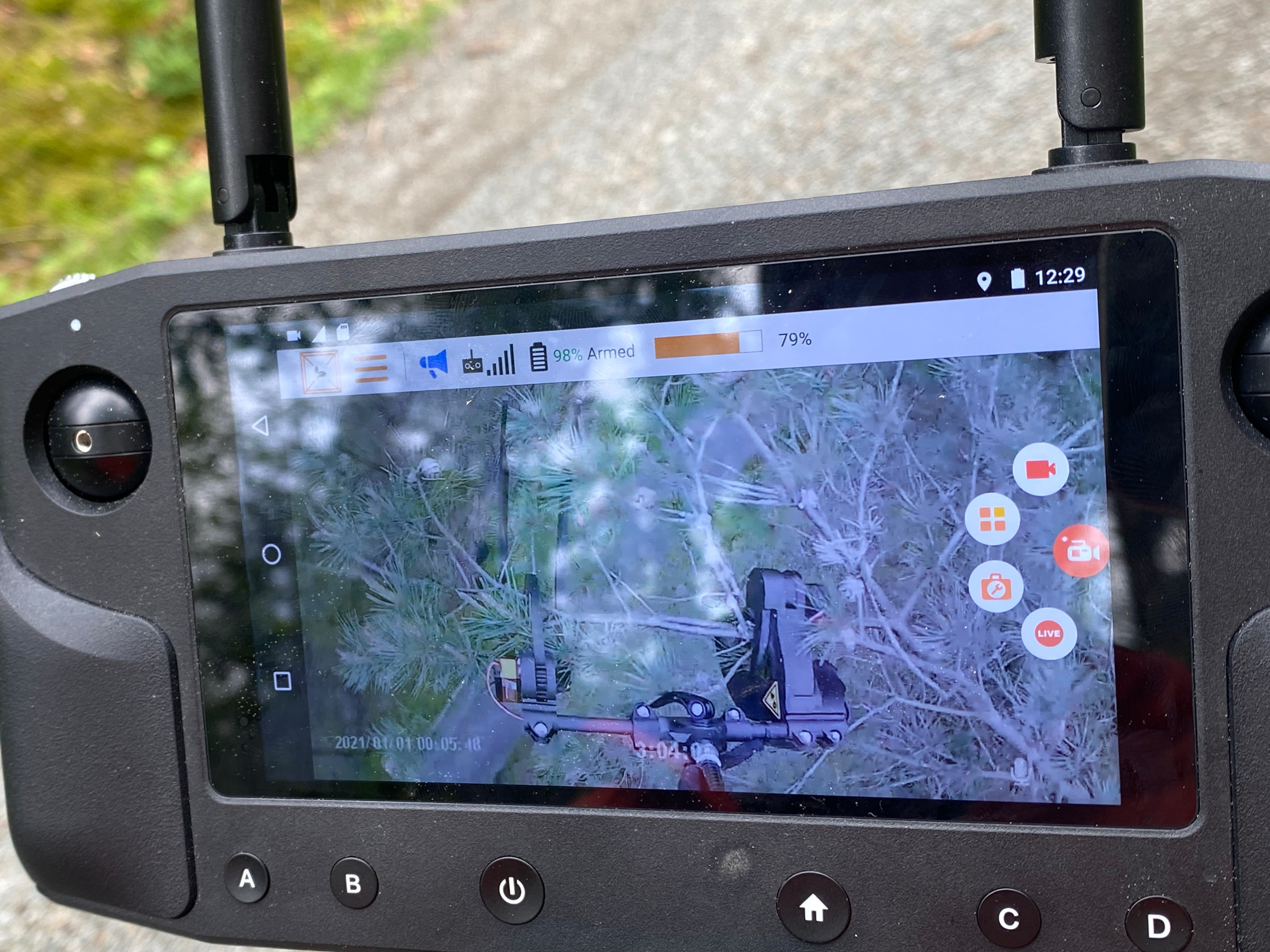
Fig. 7: Perspective of the gripper arm camera. The gripping and cutting sequence is triggered. Photo: Simon Ecke (LWF)
This low-impact method makes it possible to take samples safely and efficiently, with no need for complex and dangerous climbing operations. The use of this technology has made it possible to obtain valuable scientific data for the analysis of tree diseases and genetic information.
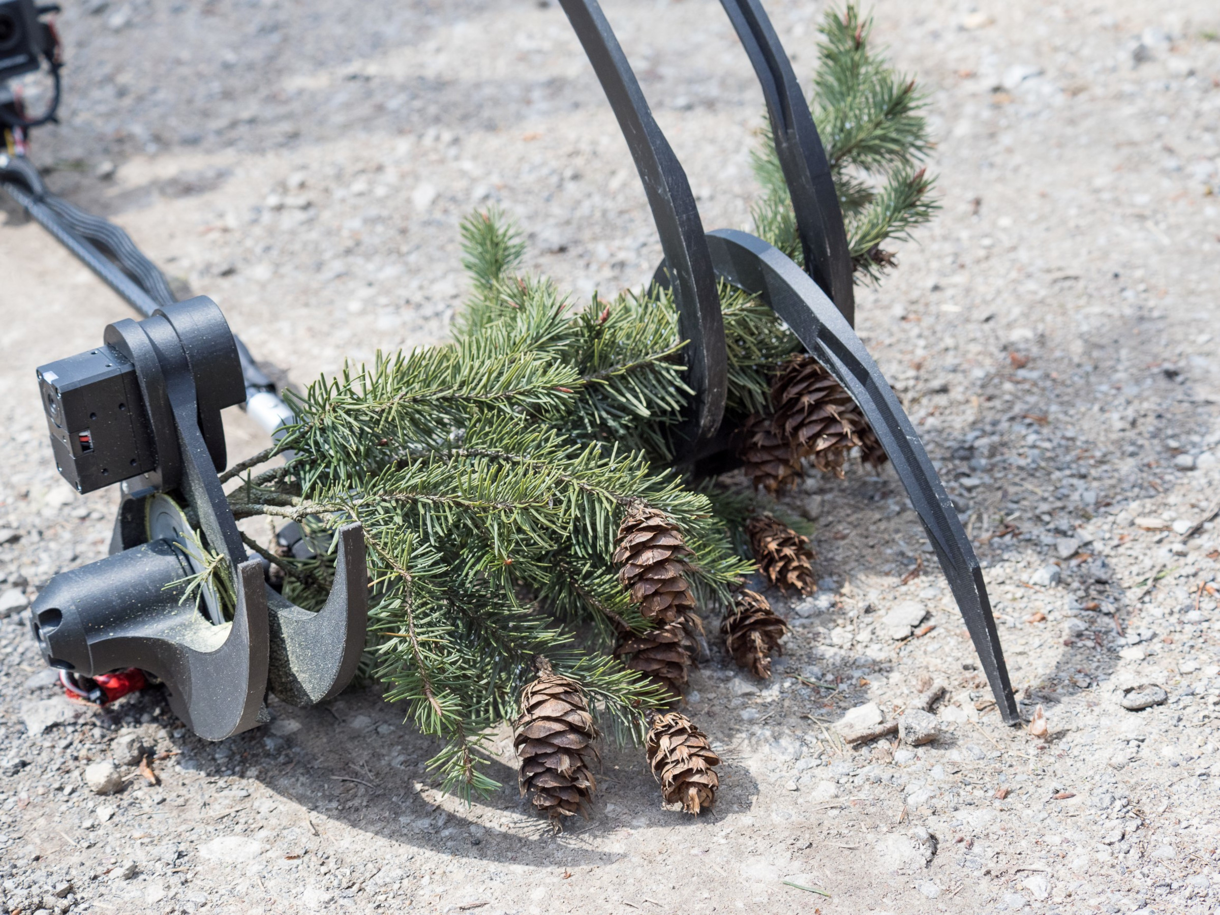
Fig. 8: Successfully removed branch sample from a Douglas fir including cones. Photo: Andreas Müller (AWG)
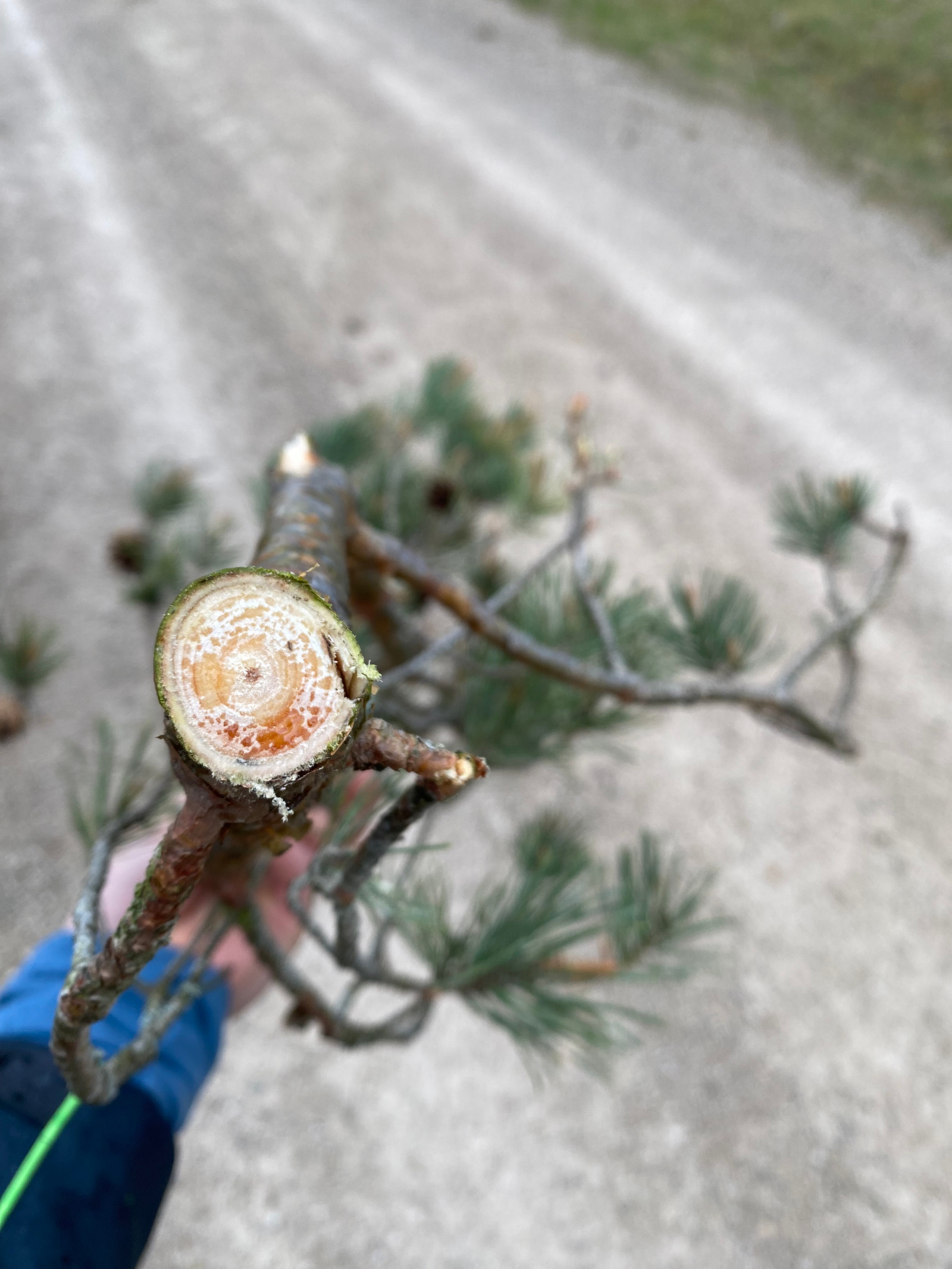
Fig. 9: Cross-section of a sample branch from a Scots pine. Photo: Simon Ecke (LWF)
Challenges and limitations of the technology
The speed of sampling with the gripper arm depends heavily on the complexity of the forest stands. The key factors are the visibility into the tree crowns, any slopes, the tree species to be sampled itself, and of course the experience of the drone pilot. It is important that the branches can be grasped easily with the gripper arm. Gnarled and highly ramified branches are difficult to grasp and may greatly increase the time needed to take samples. At least two people are required for the operation: a pilot and an observer. This is for safety reasons on the one hand, and also to ensure an optimal approach to the sample trees.
The main limitation is the number of batteries available. Samples can be taken from two to four different trees on each flight. Since the drone requires two batteries to operate, seven flights can be carried out with the 14 batteries available to us. In this way, samples can be collected from 15 to 30 trees. With an unlimited number of batteries, an experienced team can sample an estimated 40 to 80 trees per day, although this depends heavily on the type of tree and the complexity of the forest stand.
The drone flight must however be interrupted when it starts raining or when the wind is too strong.
The bottom line
Estimating the yield and quality of the seed crop in tree stands is crucial if we are to maximise productivity, use resources efficiently and ensure a secure supply of high-quality seed. Traditional crop evaluation methods are often time-consuming and resource-intensive. The use of drones is a cost-effective means of capturing high-resolution image data and taking samples directly from the tree crowns. Our UAV-SEE project shows how innovative drone technologies can be used in forestry for remote sensing and sampling. The insights gained will help us to optimise the quality of the seed crop and thus ensure the health and sustainability of the forests.