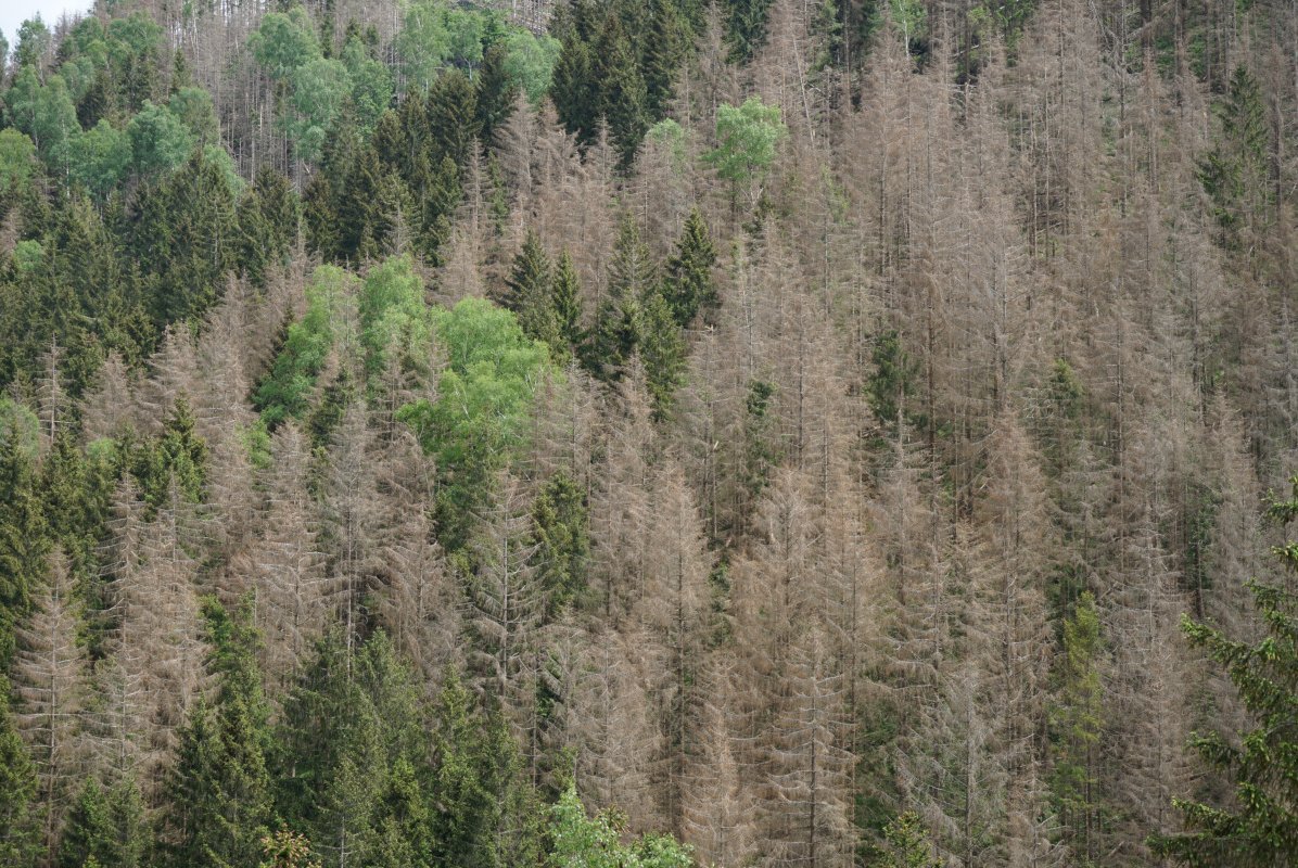
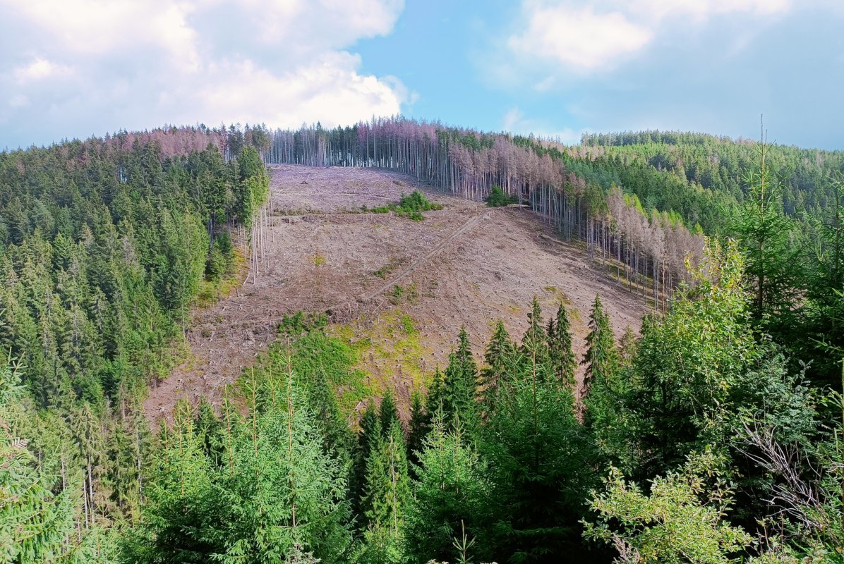
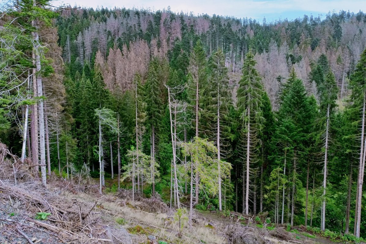
Heat waves and drought have caused significant damage in recent years, particularly in the forests of northern Bavaria. The situation is not expected to improve in the future. Instead we are likely to see a further rise in temperatures and an increase in extreme weather events. Whereas field surveys are very time-consuming and labour-intensive, remote sensing techniques offer an efficient way of mapping such damage over extensive areas and monitoring it repeatedly. Previous studies by the LWF have shown that optical satellite images can provide a large-scale overview of damaged forest areas. Finer distinction between different categories of damage is not yet possible, however.
If more precise analyses of the condition of the forest are required, to be able to identify damage such as defoliation, discolouration or crown deadwood at the individual tree level, for example, aerial images of higher spatial resolution taken from an aircraft must be used. The LWF still considers manual aerial image analysis at a stereo screen to be the most reliable remote sensing method for detecting damage to and in forests. However, this manual approach is too time-consuming for large areas such as counties or administrative districts. There is therefore a need for more efficient, automated evaluation procedures.
Against this background, the LWF's AirLaserSpec research project is investigating the possibilities of damage detection from aeroplanes, based on laser scanning technology and simultaneous aerial photography. The laser scanner provides dense 3D information on the forest areas flown over. In combination with simultaneously recorded image data, we see great potential here for a characterisation of tree crown structures. The AirLaserSpec research project is investigating whether and how accurately this technology can be used for an automated assessment of damaged deciduous trees.

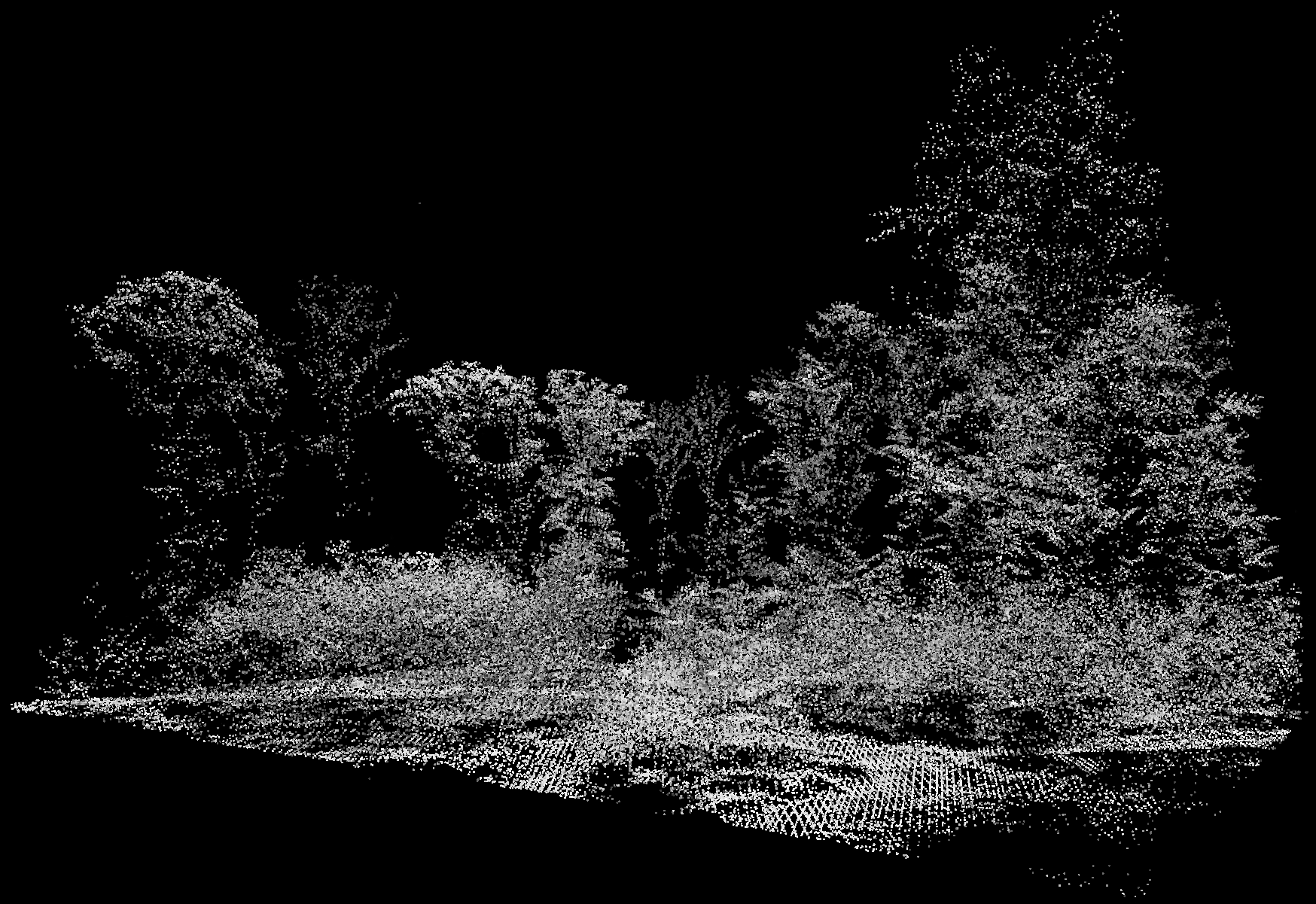
Fig. 1: The aircraft used for the aerial surveys are equipped with cameras and laser scanners. The image on the right shows the point cloud measured from the air for a section of the Waldbrunn test area in the 3D view. Photo: PRIMIS spol. s r. o.
Damage assessment from an aircraft
In July 2023, the LWF commissioned a specialist company to fly over two test areas. An aircraft equipped with both a laser scanner and a high spatial resolution multispectral camera was used. Selected for the test were two forest areas in Lower and Upper Franconia, in which the crown damage to mature beech trees varied in severity.

Fig. 2: Aerial camera with laser scanner. Photo: PRIMIS spol. s r. o.
How does the 3D laser measurement from the aircraft work?
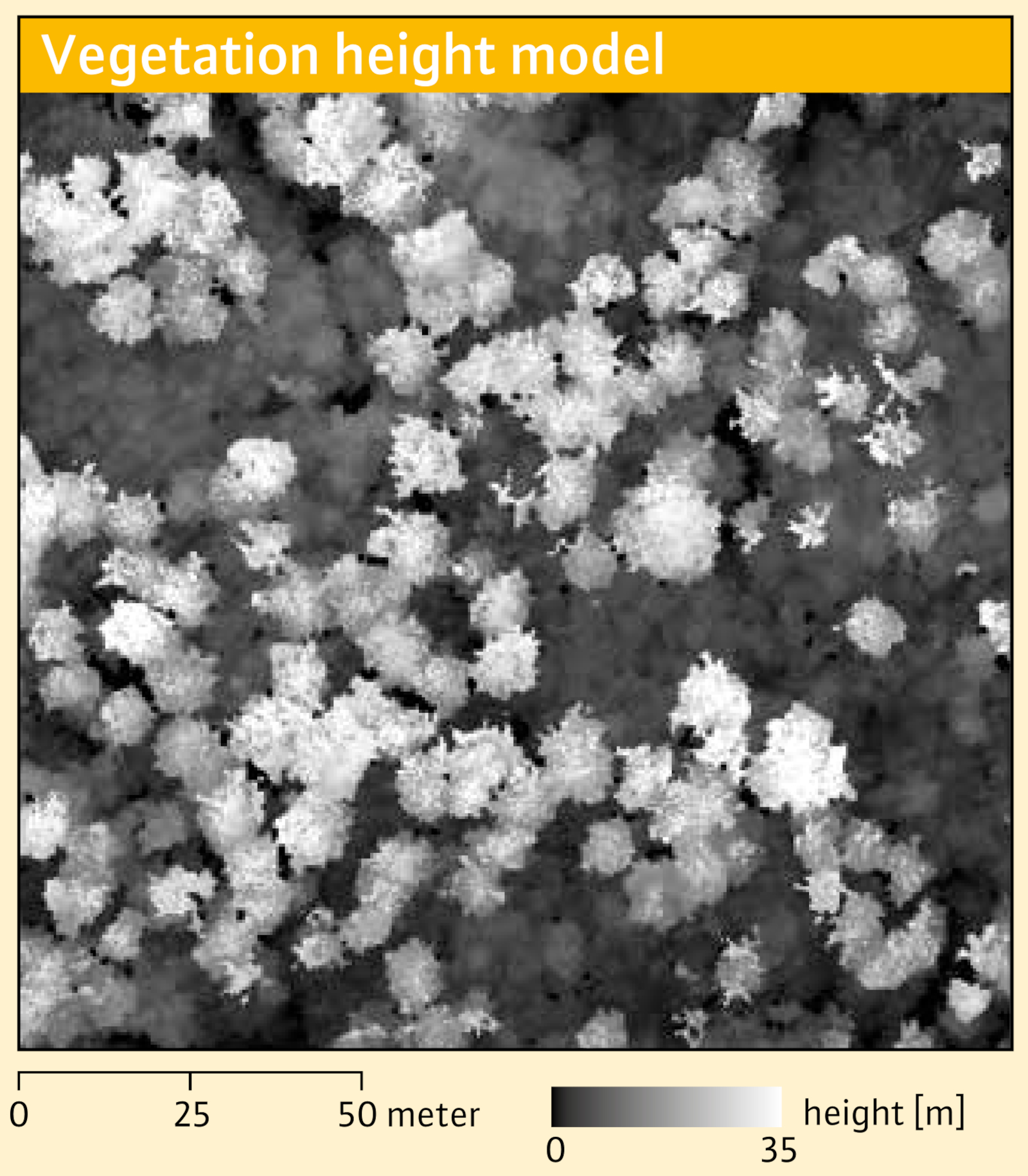
Fig. 3: A vegetation height model for a section of the Waldbrunn test area in 2D view.
The flight area is “actively” scanned with a laser scanner. The scanner emits laser light pulses at a very high frequency. These are reflected by the earth's surface and objects on it and scattered back to the sensor. The distance between the scanner and all reflective surfaces can be determined from the time that lapses between transmission and reception. A GPS receiver and an inertial navigation system in the aircraft are combined to provide precise localisation or geo-referencing of the laser measurement points. The laser scanning technology provides a high density of measurement points and, at the same time, a high degree of measurement accuracy. Numerous studies in different forest areas have established good to very good correlations between tree and stand heights from field measurements and height measurements from airborne laser scanning technology.
In the AirLaserSpec project, an average of approx. 40 laser points per m² were measured. As Figure 1 shows, this can be used to derive a dense, three-dimensional point cloud. Shown here is a small section of the Waldbrunn area from an aerial survey made in July last year.
One advantage of laser scanning technology is that, depending on the structure and layering of the vegetation, one emitted pulse can create several echoes of the backscattered laser energy. This permits a division into first reflections, last reflections and intermediate reflections.
The first reflections are usually used to calculate digital surface models (DSM). In forest areas, the DSM represents the vegetation surface or the outer “shell” of the vegetation. The last reflections can be used to derive a digital terrain model without vegetation. For the terrain reconstruction, filter algorithms are used. These identify those laser points within the last reflections that best represent the ground or the terrain below the vegetation. From the difference between these two elevation models, i.e. the surface model minus the terrain model, a so-called normalised digital surface model (nDSM) can be derived, in which the actual object heights above the terrain are mapped.
Within forest areas, the nDSM represents a vegetation height model. Figure 3 shows a small section of the calculated vegetation height model of the Waldbrunn test area with a spatial resolution of 0.5 metres. In the section shown, tree crowns in the uppermost layer (here mainly beech trees) are clearly visible. There is also a lower second tree layer. Furthermore, some individual smaller gaps in the canopy can be identified.
Simultaneous aerial photography
The multispectral camera used in the aircraft at the same time as the laser measurement records the solar radiation reflected from the earth's surface. During the aerial survey for AirLaserSpec, four spectral ranges were recorded: blue, green, red and near-infrared. As Figure 4 illustrates, different combinations of spectral bands can be used to produce both true colour images (red, green, blue) and colour-infrared images (near-infrared, red, green). Figure 4 shows the same section as in Figure 3. Due to the high spatial resolution of 0.1 m of the orthophotos, the damaged beech trees with defoliated crown sections are easily recognisable. The damaged hardwoods are particularly visible in the colour-infrared image due to the characteristic greenish-blue to greyish-white colour tones.
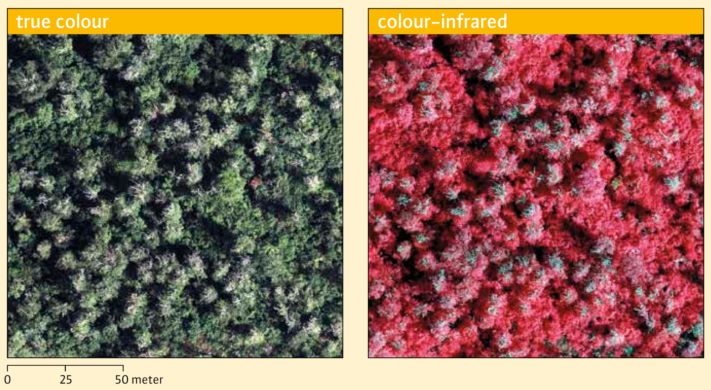
Fig. 4: True colour and colour-infrared representation of the image data captured by the multispectral camera.

Fig. 5: The Normalised Difference Vegetation Index (NDVI) was calculated using the red spectral range and near-infrared range, with the aim of highlighting differences between leafy and damaged, leafless tree crowns.
The spectral information of the aerial image data can also be analysed using vegetation indices. A vegetation index is an “artificial” band derived from the original spectral bands. Over time, numerous indices have been developed for a wide variety of optical remote sensing data and application areas. Different mathematical operations can be used, depending on the objective of the evaluation. To highlight the difference between vigorous and damaged vegetation, the combined use of the visible red spectral range and the near-infrared is suitable. This can be used for example to calculate the Normalised Difference Vegetation Index (NDVI), a very frequently used index with a value range of -1 to +1. Figure 5 shows that the trees with leaves tend to have high NDVI values. Damaged crowns, on the other hand, tend to have low NDVI values. However, it should be noted that even vegetation-free areas can have low NDVI values, which is why the use of a vegetation index alone is not usually sufficient for the assessment of damage. This is particularly true for the evaluation of large forest areas. Here, other factors that have an influence on the spectral information must be taken into account, such as the topography or the age classes of the forest stands and much more.
Future research
If we compare the orthophotos in Figure 4 with the vegetation height model in Figure 3, it becomes clear that damaged tree crowns with missing foliage are also partially recognisable in the height data. It is therefore apparent that the two data sets can complement each other. The extent to which the laser data can contribute to the improvement of the assessment of damaged tree crowns - in comparison with the use of aerial image data alone - is being investigated in the AirLaserSpec project. The use of machine learning methods for the automated classification of damage to deciduous trees is also being examined.
Simultaneous laser measurement and aerial photography make it possible to determine the size and shape of gaps in the canopy more precisely than aerial image data alone. The AirLaserSpec project is therefore also investigating whether the laser data can provide information about the presence of a vegetation layer within the gaps. Aerial images are often overshadowed in these areas and do not allow reliable conclusions to be drawn.
In addition to the aerial survey carried out in July 2023, the LWF commissioned a second flight survey campaign in July 2024. This makes it possible to compare the data from the two surveys. With the help of remote sensing methods for change detection, it is being investigated whether and how accurately changes in the state of the vegetation and tree vitality can be detected.

Fig.6: The field photo of 16 September shows severely damaged beech trees in the Ebrach test area. Photo: Johannes Jurgovsky
Summary
In forestry practice, methods are needed to detect and document damage to deciduous trees over large areas as precisely as possible. With this in mind, the LWF launched the AirLaserSpec research project. In the first phase of the project, the LWF commissioned aerial surveys using airborne laser scanning technology and simultaneous aerial photography for two project areas in northern Bavaria. The results provide both dense 3D laser measurements and high-resolution, multispectral image data of the surveyed forest areas. With the help of this data, subsequent phases of the project will investigate how accurately damaged deciduous trees can be assessed. It will also be examined whether this can be used to develop an automated evaluation procedure for damage assessment. The aim is to be able to reliably provide future users with coordinates for damaged deciduous trees.
The AirLaserSpec project is being funded by the Bavarian State Ministry of Food, Agriculture and Forestry (StMELF) (Running time: 01.10.2023 - 30.11.2027).